



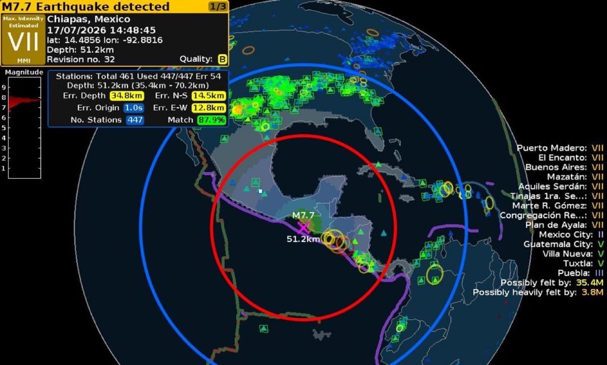
A powerful earthquake struck off the Pacific coast of Chiapas, Mexico, on Friday, close to the Guatemala border, triggering a tsunami warning and prompting precautionary inspections of infrastructure across the region. The US Geological Survey (USGS) initially recorded the quake at magnitude 7.4, before later revising the figure down to 7.3, though it remains classed as a very powerful earthquake.
The earthquake struck at approximately 14:48 UTC, close to Puerto Madero, a major Pacific port and fishing town located roughly 13km from the Guatemalan border. Its epicentre was situated roughly 44 miles (70km) west-southwest of Puerto Madero, off Mexico’s Pacific coast in the state of Chiapas, according to Wikipedia. Shaking was reported across southern Mexico and into neighbouring Guatemala, reflecting the scale of a quake occurring within a highly active seismic zone.
How powerful was the earthquake?
According to the USGS, the earthquake struck at a depth of 10km (6.21 miles). Shallower earthquakes of this kind generally produce more intense and concentrated shaking and damage than deeper ones, which is part of why such a powerful tremor was felt so widely across the region. Quakes of this magnitude regularly trigger destructive secondary hazards, including tsunamis and landslides.
Tsunami threat and monitoring
A tsunami warning was triggered shortly after the earthquake struck, with the USGS confirming that the threat applies to parts of the Pacific located closer to the epicentre. According to the USGS, “hazardous tsunami waves” are possible for coastlines located within 300km of where the earthquake struck. The Pacific Tsunami Warning Center evaluated the event for possible tsunami generation, a standard procedure following large offshore earthquakes in the region, according to Wikipedia. Authorities were continuing to assess the potential for local waves, though the broader risk of a distant tsunami reaching other coastlines was considered generally low given the nature of the event. Coastal residents in the immediate area were advised to follow official guidance closely as the situation developed.
Why the region is prone to major quakes
The earthquake occurred along the Middle America Trench, where the Cocos Plate is subducting beneath the North American Plate, a geological process that makes southern Mexico one of the most seismically active regions in the world, according to Wikipedia. The USGS issued a Green alert for the earthquake, indicating a low likelihood of significant casualties or economic losses based on its preliminary impact assessment, according to sms-tsunami-warning.com.
What happens next
Seismologists are expecting aftershocks in the coming hours and days, with some potentially strong enough to be widely felt across the region, according to EarthSky. Authorities in Chiapas have begun precautionary inspections of infrastructure, public buildings and transport networks to check for any structural damage caused by the quake, according to ITV News. As of the latest reports, there have been no widespread confirmed accounts of major casualties or damage, though the situation remains under close review by local authorities.
