



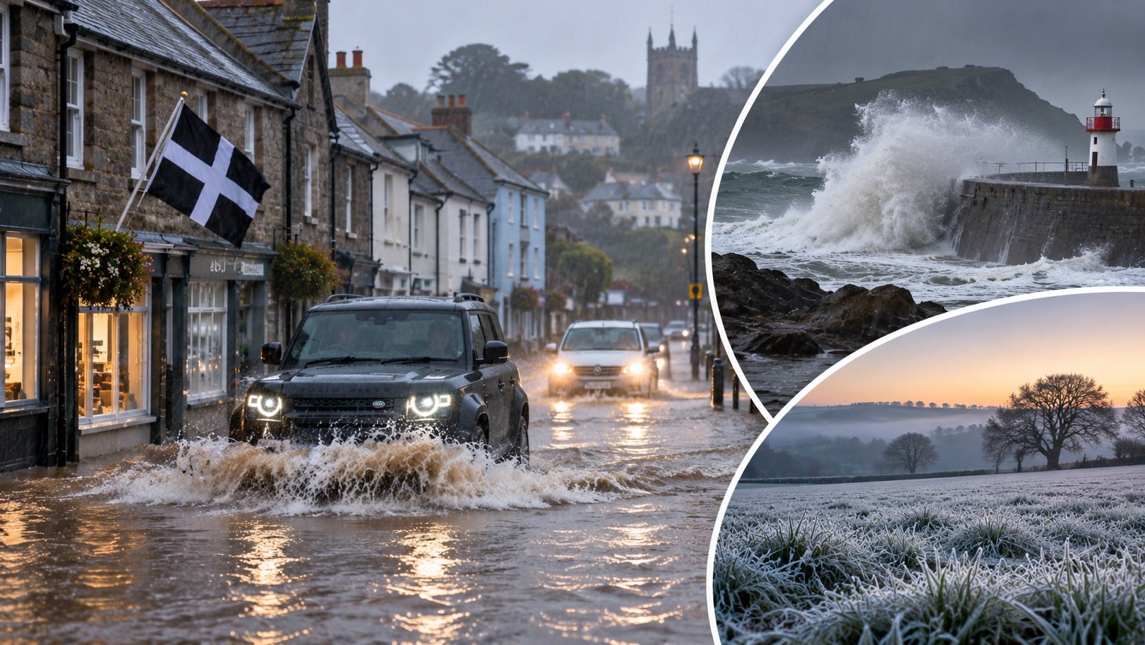
Roads are blocked in Falmouth and near Helston, while the Environment Agency lists 19 flood alerts across Devon. Elsewhere, a widespread frost is forecast for northern and eastern areas overnight.
Heavy rain across south-west England has flooded roads in Cornwall, and the Environment Agency has 19 flood alerts in place across Devon. A Met Office yellow rain warning covers parts of the South West for the rest of Sunday, including Exeter, Plymouth and Cornwall. Meteorologist Greg Dewhurst said some parts of Dartmoor could see 80mm to 100mm of rain. In the north and east of England, rural temperatures could fall as low as -5C overnight.
Rain and warnings in the South West
The Met Office said heavy rain had set in across the region and urged people to “take extra care if you are travelling today as conditions will be treacherous at times”.
Mr Dewhurst described the weather pattern as slow-moving, with the front not clearing quickly. “We’re expecting some very heavy rain across parts of Devon and Cornwall in particular, for a Met Office yellow rain warning in force for much of the day,” he said. “So, there could be some localised disruption as we move through the day ahead.” He said widely across Devon and Cornwall around 40mm could fall, locally 60mm in the south and perhaps 80mm to 100mm on Dartmoor. “This is likely to lead to some flooding disruptions, so it is worth staying up to date to our warnings,” he said.
Flooding in Cornwall
ITV News West Country reported that flooding had made roads impassable in parts of south Cornwall. Water affected Arwenack Street, Bank Place and Swanpool Street in Falmouth from shortly after 11am. The B3304 Porthleven Road near Helston was blocked in both directions between Penventon View and Ratcliffes Lane on Sunday afternoon, and a road in Gweek was covered by floodwater. Residents there reportedly worked together to clear blocked drains so the water could drain away. The current status of the closures has not been established.
The Environment Agency warned that river levels in parts of Cornwall could stay high into next week, with more prolonged rain forecast for Monday and Tuesday. It identified seven areas in the Fal and Helford catchments: The Lizard, Penryn, Falmouth, Truro, Ladock, Tresillian and Grampound, noting low-lying roads near rivers as particularly vulnerable. A separate river flood alert covers west Cornwall, including Penzance, Newlyn, Crowlas, Porthleven, St Ives, Hayle, Camborne, Portreath and Perranporth.
Devon coast and rivers
Earlier in the day the Environment Agency had flagged more than 25 areas of England at risk of flooding, including stretches of the South Devon coast at Beesands, Torcross, Slapton and Dawlish. It removed the flood warning for those four communities at 2.22pm on Sunday. A wider coastal flood alert was still in place at 2.30pm, covering Torbay, Teignmouth, Beesands, Torcross, Slapton and Dawlish. The agency says a flood alert means flooding is possible, while a flood warning means it is expected.
It forecast a high tide at Teignmouth at 4.15pm, at 2.04 metres above Ordnance Datum, 0.31 metres above the tide-table level. Northeasterly force 4 winds and offshore waves of more than 1.6 metres were also forecast.
The agency’s Sunday afternoon update listed 19 flood alerts across Devon and adjoining catchments, including the Dart, Teign, Plym, Yealm, north Dartmoor rivers and the Exe system. Several were updated between 2.55pm and 2.59pm. These cover river as well as coastal flooding, and removing one coastal warning does not mean the wider risk has passed.
Frost and cold elsewhere
Away from the south-west, the Met Office said a frosty start should give way to a dry day with some sunny spells. Widespread frost is expected overnight across northern and eastern areas, with rural temperatures potentially reaching -5C. On Friday 20 November, the UK recorded its coldest night since 9 January, when Tulloch Bridge fell to -10.6C. The first snow warning of the season was issued earlier in the week, and more than an inch was recorded in parts of northern England.
The UK Health Security Agency has a yellow cold health alert in force for the North West, North East and Yorkshire and the Humber until 9am on Tuesday. It means the weather could increase use of healthcare services and raise the risk to life for vulnerable people.
The week ahead
The Met Office’s 21 November forecast said a clash between Atlantic weather systems and higher pressure to the east could bring further slow-moving rain to western areas in the first half of the week. Some higher ground in northern Britain could see snow later in the week, though the timing, location and amounts are uncertain. The Met Office’s warning includes the possibility of power cuts, road closures and transport delays. No widespread power outage from Sunday’s rain was confirmed in the sources available.
